
1
of
2
Loading...
CHCNAV | SKU:
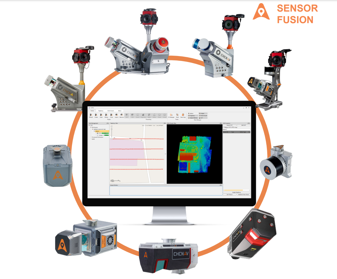
CoPre Lidar Data Processing Software
$0.00
Unit price
/
Unavailable
CoPre is a powerful software ecosystem developed by CHCNAV that enables users to process mobile geospatial mapping data quickly and efficiently.
CoPre features accurate trajectory processing by a proprietary algorithm, point cloud and image georeferencing, point cloud colorization, filtering, and additional useful functions such as digital ortho model (DOM) generation, significantly improving postprocessing accuracy.
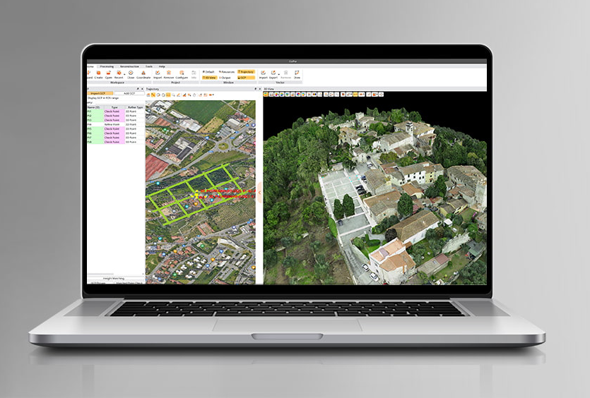
CoPre is built around a simple and intuitive user interface. Geospatial professionals can export point clouds and image files without opening third-party software for the positioning and orientation system (POS) computations. It enables the analysis of complex information structures with absolute precision and empowers the world of 3D data processing. CoPre software is the backbone of CHCNAV's LiDARs system series, and it's regularly updated with new features, functionality, and tools.
CoPre features accurate trajectory processing by a proprietary algorithm, point cloud and image georeferencing, point cloud colorization, filtering, and additional useful functions such as digital ortho model (DOM) generation, significantly improving postprocessing accuracy.
CoPre is built around a simple and intuitive user interface. Geospatial professionals can export point clouds and image files without opening third-party software for the positioning and orientation system (POS) computations. It enables the analysis of complex information structures with absolute precision and empowers the world of 3D data processing. CoPre software is the backbone of CHCNAV's LiDARs system series, and it's regularly updated with new features, functionality, and tools.
CoPre features
An advanced, user-friendly 3D laser scanning data processing software.
CoPre LiDAR Processing Software
A powerful software ecosystem that enables users to quickly and efficiently process mobile geospatial mapping data.

